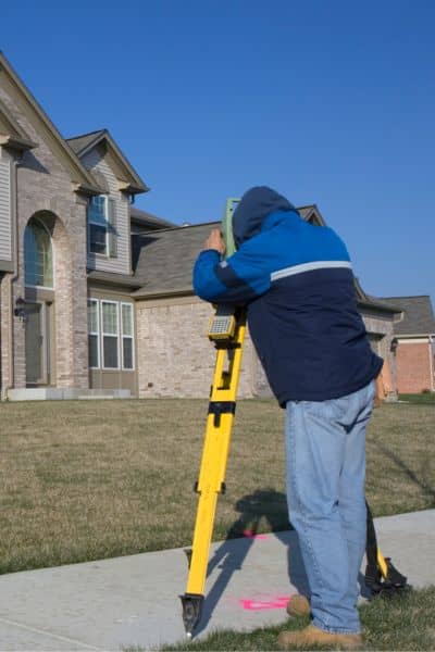
Buying a home is exciting, but it also comes with details that can feel overwhelming. One document that often causes confusion is the boundary survey. Many buyers walk into the closing table expecting to get an original stamped survey in their hands. Instead, they leave with a copy, and sometimes not even a physical one—just a PDF. That gap between expectation and reality has become such a hot topic that it recently blew up on Reddit, with buyers venting about why they never seem to get the “real” thing.
So, what’s actually going on? And does it matter if you don’t get an original?
The Buzz from Reddit
In the past week, a viral thread on r/RealEstate summed up what a lot of homebuyers have wondered: “Shouldn’t I get the original stamped boundary survey when I close on my house?” The comments were a mix of frustration and misinformation. Some users insisted the buyer owned the survey. Others said the title company kept it. A few mentioned that surveyors never release the original at all.
The truth sits somewhere in the middle, and understanding the process can save you from stress. A boundary survey isn’t like a deed or a mortgage note. It’s a professional service product, and the way ownership works often surprises people.
Who Actually Orders the Survey?
Here’s the first key point: most homebuyers don’t personally order the survey. In many cases, the lender or the title company hires a licensed surveyor to prepare it. Their goal is to protect their financial interest in the property. They need to confirm that no encroachments or line disputes exist that could affect the title or the loan.
That means the “client” in the eyes of the surveyor isn’t always the buyer—it might be the bank. Because of that, the original stamped survey often stays with the party who ordered and paid for it. Buyers typically receive certified copies for their records and closing documents.
Why Surveyors Keep the Original
Surveyors in Mississippi, just like in other states, hold professional responsibility for their work. The original sealed drawing is part of their record. It’s not just a piece of paper—it’s a legal instrument that must be maintained under state board rules. By keeping the original, surveyors protect the integrity of the survey and ensure they can provide it in case of disputes or legal questions later.
That doesn’t mean buyers are left empty-handed. Copies, whether digital or paper, are valid for showing where your property begins and ends. For lenders and title insurers, a certified copy carries the same authority as the original.
When a Copy Isn’t Enough

Still, there are times when a copy won’t cut it. If you plan to build a new structure, split your lot, or settle a neighbor dispute, you may need a fresh boundary survey instead of relying on a previous one.
Common situations include:
- Purchasing a property that hasn’t been surveyed in decades.
- Discovering fences, driveways, or sheds that don’t match the lot lines.
- Subdividing land in Tupelo or other growing communities.
- Building near a floodplain or within a special overlay district.
In these cases, the lender or city permitting office will usually require an updated survey, not just a recycled copy.
How Buyers Can Get Access
If you really want to see the survey, you do have options. You can ask the title company for the version included in your closing packet. If that isn’t enough, you can request a copy directly from the surveyor. Keep in mind, they may charge a fee, especially if the file is old. County records sometimes show surveys, but not always, and often without the surveyor’s seal.
It helps to remember that a surveyor’s work is copyrighted. You don’t “own” the drawing the way you own your deed. Instead, you have licensed use of it, and that’s usually all you need for closing or future reference.
Tupelo Buyers: Using GIS Wisely
If you’re buying in Tupelo, you’ve probably seen the city’s GIS maps online. They’re a handy way to check things like flood zones, overlays, and property dimensions. But here’s the catch: GIS data is only approximate. It’s not a legal survey.
Too many buyers rely on those colorful maps without realizing they can be off by several feet. That’s why lenders and title companies still require boundary surveys, especially in areas near creeks, historic districts, or older subdivisions. A GIS map is a great starting point, but a licensed survey is the finish line.
The Drone Factor
Interestingly, another Mississippi Reddit thread this week showed people complaining about “drones buzzing everywhere.” That frustration connects back to land surveying, too. Many boundary surveys now involve drones to capture topographic data or aerial images.
For buyers, that can feel intrusive, but here’s the reassurance: licensed surveyors follow FAA rules, respect privacy, and keep flights limited to what’s necessary. Drone surveying actually improves accuracy and speeds up projects. In a fast-growing place like Tupelo, that efficiency matters.
What Homebuyers Should Remember
At the end of the day, the confusion about originals versus copies boils down to expectations. Buyers want certainty. They want something official they can hold. The good news is that the copy you receive is legally sound and good enough for most purposes.
But don’t ignore red flags. If the survey looks outdated, if your property lines seem fuzzy, or if your neighbor raises questions, call for a new boundary survey. It’s a small investment compared to the cost of a legal dispute.
Final Thoughts and Local Tip
Homebuyers rarely leave the closing table with an original stamped survey, and that’s normal. The original belongs in the surveyor’s file. What matters most is having a survey—original or copy—that clearly defines your lot lines.
If you’re buying a home, don’t get caught up in myths or mixed advice. The real priority is making sure your boundary survey is accurate and current. And if you’re uncertain, reach out to a professional before closing.


