Drone land surveying is changing fast, and Tupelo is right in the middle of it. In the past few days, two major updates have made waves in the surveying world. The U.S. government is signaling tighter restrictions on Chinese-made drones like DJI and Autel. At the same time, the Federal Aviation Administration (FAA) is moving forward with a new Beyond Visual Line of Sight (BVLOS) rule. For surveyors and clients, both shifts could reshape how projects get done, from subdivision layouts to floodplain studies.
A Turning Point for Surveying
For years, many small surveying firms across North Mississippi have relied on DJI drones such as the Mavic 3E and Matrice series. These tools are reliable, affordable, and precise for mapping. Now, their future is less certain. Import scrutiny may limit supply, and the new FAA rule may expand how flights can be conducted. Together, these changes create both risk and opportunity for Tupelo’s survey community.
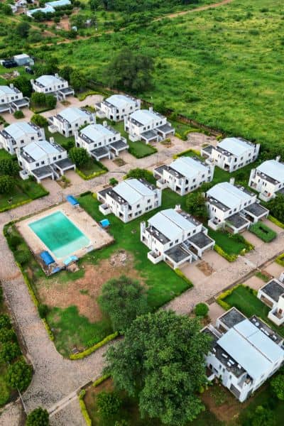
Picture a subdivision project on the edge of town. Right now, a survey crew might need two spotters to keep an eye on the drone. That adds cost and time. Under BVLOS rules, the same surveyor could fly a longer corridor with fewer people on the ground. Days could be saved. On the flip side, if DJI parts or replacements are blocked, delays may creep in. Tupelo firms are preparing for both outcomes.
What Changed This Week
The Commerce Department’s signals around drone imports have raised alarms. DJI and Autel supply a huge share of the survey drones in the United States, and is no exception. Restrictions could make it harder to bring in new units or even get spare batteries and gimbals.
Meanwhile, the FAA’s proposal for BVLOS flights is gaining attention. The rule would allow licensed operators to fly drones farther without a visual observer. It also sets training, airworthiness, and operational standards. For drone land surveying, this could simplify workflows on projects that cover long tracts of land.
How Survey Firms Are Adjusting
Surveyors are not waiting to react. Many are auditing their equipment—checking battery health, stocking extra props, and updating firmware. Others are testing alternatives such as Skydio, Parrot, or U.S.-made UAV systems. These options cost more, but they reduce the risk of downtime if Chinese drones become harder to use.
Data consistency is another focus. Switching from one drone to another can create slight differences in the photogrammetry results. Orthomosaics, point clouds, and elevation models must align with earlier surveys. To solve this, some firms are running side-by-side flights. This ensures developers and city planners still receive data that matches past projects.
The Compliance and Procurement Puzzle
One of the toughest questions today is whether to repair, replace, or upgrade. DJI drones remain usable for now, but new purchases may face roadblocks. Will the next model clear FCC approval? Will software access remain open? These unknowns make planning difficult.
A practical decision tree is emerging:
- Maintain the drone and stock parts if it still works well.
- Replace it now if downtime risk is high.
- Cross-grade to a new platform if budgets allow and long-term stability is needed.
For firms bidding on subdivision or road projects, this decision is critical. Clients expect quick delivery, and no one wants a grounded fleet to slow construction.
Where BVLOS Could Make the Biggest Local Impact
While supply issues cause stress, the BVLOS rule could unlock new efficiency. Tupelo stands to benefit in several areas:
- Floodway and levee monitoring: The city has flood-prone zones. BVLOS flights would allow surveyors to cover wider areas, supporting FEMA elevation certificates and floodplain studies.
- Subdivision earthworks: Developers across Lee County face deadlines. Drone land surveying under BVLOS could speed up grading checks and progress reports.
- Utility corridors: Power line and pipeline surveys often stretch for miles. Extended flights without observers would save both time and money.
These are projects where clients will notice faster results and, in some cases, reduced costs.
What Clients Need to Know
If you’re a developer, builder, or homeowner, these changes affect you too. When hiring a surveyor, ask about their drone strategy. Do they have a plan for BVLOS flights? Are they ready with backup drones if DJI models become limited? A proactive firm will deliver more reliable results.
Homeowners needing property surveys or elevation certificates should feel reassured. Licensed surveyors are already adapting. Still, expect clearer conversations about timelines, equipment, and pricing. For lenders and attorneys, this is a reminder to choose surveyors who understand both compliance and modern drone technology.
The Bottom Line
Drone land surveying is entering a new phase. The FAA’s BVLOS rule could speed up projects and reduce staffing needs. At the same time, U.S. scrutiny of DJI and Autel raises questions about supply chains. Surveyors are preparing by maintaining fleets, testing alternatives, and refining workflows.
For clients, the takeaway is simple: work with surveyors who stay ahead of policy and technology. If you’re planning a subdivision, flood study, or property development, now is the time to hire a licensed land surveyor who understands how FAA rules and drone tools connect.
