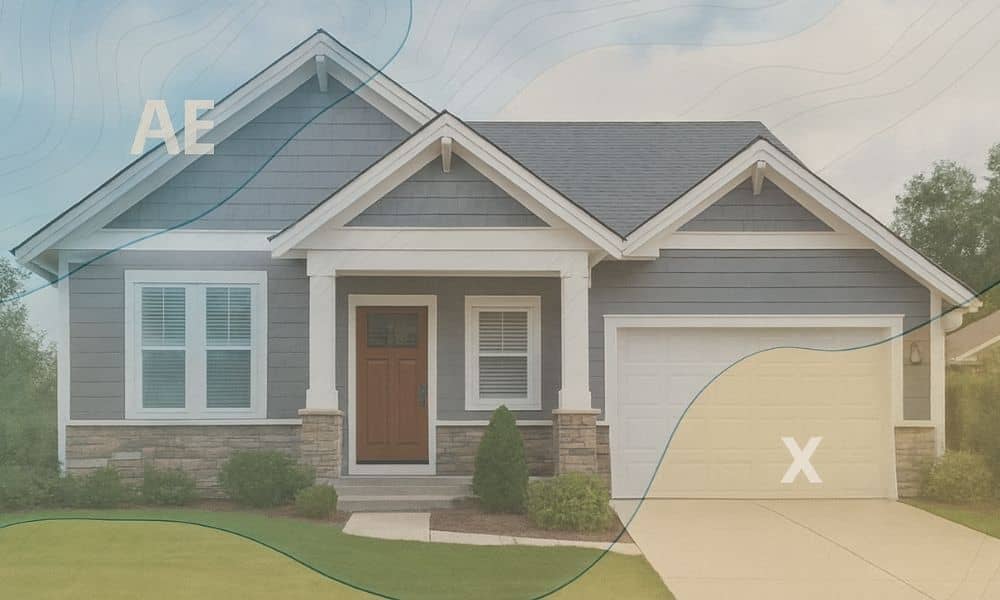
Flood zones are changing fast across the country, and many homeowners don’t realize it until their insurance company suddenly reaches out. In some places, families have opened their mail to find a surprise notice telling them their home is now in a high-risk flood zone. When that happens, the first question is always the same: “How can I fix this?” The answer often starts with one document—an elevation certificate. This surveyor-prepared report can prove your home sits higher than FEMA’s maps suggest, and it can save you thousands of dollars each year.
In Tupelo, this is important. FEMA updates flood maps on a schedule, and new development often triggers the next wave of changes. Since Tupelo and Lee County continue to grow with new homes, rezoning, and commercial projects, local maps may change again. That’s why 2025 is a smart time to pay attention.
Flood Map Changes in Other Cities Show a Clear Warning
Across the country, FEMA has been redrawing flood maps, and the results have shocked people. In St. Joseph County, Michigan, new maps dropped with almost no warning. Surveyors were shown on the news flipping through thick stacks of updated panels. Some families discovered overnight that their homes were now marked as high risk, even though nothing had physically changed on their property.
In Summerside, Canada, the city council rejected proposed flood-plain updates after residents pushed back. People worried about property values, insurance bills, and restrictions on building. These stories show a clear trend: flood maps are shifting quickly, and homeowners often lose control over what happens next.
If those changes can happen in Michigan or Canada, they can happen in Mississippi too. Flood maps don’t update based on local politics; they update based on data. Tupelo is growing fast, which means FEMA will eventually look our way.
Why Tupelo Could Be Next in Line for a Map Update
Tupelo has seen steady development over the past few years. The city approved rezoning for roughly 12.8 acres to allow more low-density housing. While that may not sound major, new streets, driveways, and roofs all change how water flows in a storm. As communities grow, drainage shifts, low spots become more stressed, and old flood maps begin to lose accuracy.
FEMA watches these changes closely. When enough new data appears—such as new subdivisions, altered drainage paths, or updated hydrology models—they review the area and sometimes redraw the flood zones. That’s why a home in Zone X today might end up in Zone AE next year without the owner doing anything at all.
Tupelo has a mix of older neighborhoods, newer developments, and creek-side homes. That combination makes it likely that the city will see future map revisions. So even if your home feels safe today, the next update could say something different.
A New Flood Zone Can Cost Thousands, but an Elevation Certificate Can Fix That
When a property gets added to a flood zone, lenders respond fast. Most send a 30- to 45-day notice telling the homeowner that flood insurance is now required. The premium isn’t cheap. Many families see annual costs between $1,200 and $3,500. Over the span of a mortgage, that can add up to more than $25,000.
This is where the elevation certificate matters. FEMA’s maps are based on broad elevation models. They estimate the height of land in large squares, not at specific houses. Surveyors, however, measure the actual foundation height of your structure. Sometimes that height is much higher than FEMA assumes. If the official elevation certificate shows your home sits above the Base Flood Elevation, you can challenge the map’s decision.
Insurance companies and lenders accept this document. When it shows your home is safe, they often cancel the flood-insurance requirement. And because the process relies so heavily on clear, accurate data, having official home elevation verification in hand gives you something solid to show your lender. It takes the guesswork out of the conversation and often leads to a lower premium, even if insurance is still required.
How the Appeal Process Works When a Flood Map Changes

If FEMA or your lender says you are in a flood zone, you don’t have to simply agree. There is a formal appeal method called a Letter of Map Amendment, or LOMA. This process lets you prove that your home sits higher than FEMA’s model shows.
The process begins with the elevation certificate. Once the surveyor measures your home, you can submit the certificate to FEMA along with your deed, plat, lender’s notice, and photos if needed. FEMA reviews the documents and decides whether your home should be removed from the flood zone. When approved, lenders usually update your insurance requirements right away.
This process protects homeowners from being forced into costly insurance policies based on outdated or broad modeling. It puts the power back into your hands.
How to Know If You Should Get an Elevation Certificate in 2025
Not every homeowner needs one right now, but many should think about it. If you live near a new subdivision, for example, grading and construction may change how water flows toward or away from your lot. That alone can push FEMA to revise your map sooner than expected.
If your street has dips or past drainage problems, that’s another warning sign. Even if you’ve never had water on your property, FEMA reacts to patterns, not personal history.
Buyers and sellers should also consider getting a certificate early. If you’re buying a home near a creek or toward the bottom of a hill, having elevation data helps you understand long-term risk. If you’re selling, a certificate can protect your asking price and avoid surprises at closing.
Some lenders also run their own flood-zone determinations before FEMA announces new maps. Having your elevation certificate ready puts you ahead of any sudden changes.
How Homeowners Can Stay Prepared for Future Flood Map Updates
Even though new flood maps may not appear tomorrow, preparation matters. Keeping your property documents organized helps you respond fast if something changes. Your deed, plat, and past surveys all help the elevation review go smoothly.
Talking with a local surveyor before issues arise is also smart. A short conversation can help you understand how your lot sits compared to nearby flood zones. Many surveyors can spot early signs that a map change might affect your street.
For investors and homeowners planning remodels, including an elevation certificate in your planning checklist can help avoid delays and budgeting surprises later.
Final Thoughts
Flood maps across the country are changing quickly, and homeowners often don’t realize the impact until they receive a letter from their lender. With Tupelo’s steady growth, the area could see its own map updates in the coming years. When that day arrives, homeowners who already know their true elevation will be in a stronger position.
An elevation certificate isn’t just a form. It’s a financial shield, a negotiation tool, and one of the best ways to protect your property value. In a year when FEMA may revise more maps, this simple document can give you clarity, confidence, and thousands of dollars in savings.


