Welcome to ALTA Survey Mississippi

Your Final Stop for Your ALTA Survey Needs!                              Contact us today for a free quote!

This site is intended to provide you with information on ALTA Surveying in Mississippi. If you’re looking for a Mississippi Land Surveyor, you’ve come to the right place. If you’d rather talk to someone about your land surveying needs, please call our toll-free number at (888) 808-9783 today. For more information, please continue to read.

ALTA Survey Mississippi

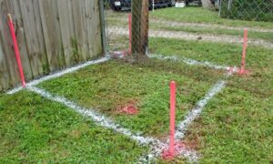
Land Surveyors are professionals who make precise measurements to determine the size and boundaries of a piece of real estate.  While this is a simplistic definition, boundary surveying is one of the most common types of surveying related to home and land owners. If you fall into the following categories, please click on the appropriate link for more information on that subject:

ALTA Survey Mississippi services:

    1. I need to know where my property corners or property lines are. (Boundary Survey)
    2. I have a loan closing or re-finance coming up on my commercial property. (ALTA Survey)
    3. I need a map of my property with contour lines to show elevation differences for my architect or engineer. (Topo Survey – ALTA Survey plus Table A Item 5.)
    4. I’ve just been told I’m in a flood zone or I’ve been told I need an elevation certificate in order to obtain flood insurance or prove I don’t need it. (Flood Survey)
    5. I’m purchasing a lot/property for a commercial use. (ALTA Survey – Item 5 and/or Item 11b may also need to be discussed.)
    6. I’m purchasing a larger tract of land, acreage, that hasn’t been subdivided in the past. (Boundary Survey)
author avatar
Surveyor

More Posts

Temporary road barriers set up for street repair work, showing where a boundary survey may help define public and private areas
boundary surveying
Surveyor

How a Boundary Line Survey Keeps Street Repairs on Track

The City of Tupelo recently announced a road-condition survey to figure out which neighborhoods will get their streets fixed first. It’s part of a plan to repair potholes, replace damaged pavement, and improve drainage all over the city. Most people are happy about it, but few realize that private surveys—especially

Read More »
Aerial view of suburban homes with a flood map overlay showing how an ALTA title survey reveals real property elevations and flood risk
alta survey
Surveyor

What Flood Maps Miss and an ALTA Title Survey Reveals

When the news broke that a Montana town changed its FEMA flood maps—only to get hit by real flooding weeks later—homebuyers across the country started asking questions. Could the same thing happen here in Tupelo, Mississippi? The story went viral because it revealed something important: flood maps can change, but

Read More »
Engineers using survey drones over a construction site to capture aerial mapping data
land surveying
Surveyor

How FAA’s Part 108 Impacts Survey Drones Nationwide

Survey drones are changing how Tupelo looks at land. For years, local surveyors and developers have used these small flying tools to capture aerial data, map flood zones, and inspect big properties. Now, with the FAA’s new Part 108 proposal, these drones could soon fly farther and work faster than

Read More »
Homebuyers reviewing a boundary survey copy with an agent at the closing table
boundary surveying
Surveyor

Boundary Survey Confusion at Home Closings

Buying a home is exciting, but it also comes with details that can feel overwhelming. One document that often causes confusion is the boundary survey. Many buyers walk into the closing table expecting to get an original stamped survey in their hands. Instead, they leave with a copy, and sometimes

Read More »
Homeowners reviewing a property line survey with a contractor before starting a fence project
boundary surveying
Surveyor

Why a Property Line Survey Protects Homeowners

If you’ve ever thought about putting up a new fence, you probably imagined the fresh wood smell, the neat border, and the sense of privacy it brings. But before the first post goes into the ground, there’s one thing many homeowners overlook: a property line survey. Skipping it can lead

Read More »
Surveyor using a total station during a construction survey on a city street
land surveying
Surveyor

Why Every Road Upgrade Starts with a Construction Survey

When you hear the rumble of heavy equipment down the street, chances are a construction survey has already taken place. In Tupelo, every major road upgrade, gas line replacement, or utility improvement begins with surveyors taking points and mapping out the work. Without this step, crews would be guessing where

Read More »