When the news broke that a Montana town changed its FEMA flood maps—only to get hit by real flooding weeks later—homebuyers across the country started asking questions. Could the same thing happen here in Tupelo, Mississippi? The story went viral because it revealed something important: flood maps can change, but water doesn’t always follow paper lines. That’s where an alta title survey becomes a powerful tool. For anyone buying property near creeks, ditches, or low-lying areas, this detailed survey helps you see what flood maps might miss. It’s not just for big developers; it’s for anyone who wants to protect their investment from surprises.
Flood Maps Are Changing—and So Are the Rules
FEMA updates flood maps through a program called Risk MAP. The goal is to make maps more accurate as new drainage studies come out. Lee County, where Tupelo sits, is part of that ongoing update. When those new maps become “effective,” lenders, insurers, and homebuyers all feel the impact.
If a property moves into a higher-risk zone, flood insurance can skyrocket. If it moves out, lenders might drop the insurance requirement—but that doesn’t mean the risk is gone. The viral Montana story showed exactly that problem: the map said “low risk,” but the land still flooded.
In Tupelo, that lesson hits close to home. Heavy rain along Town Creek or Mud Creek often overwhelms old drainage systems. When maps change, a smart buyer verifies the truth on the ground before closing.
How an ALTA Title Survey Helps You See the Whole Picture

An alta title survey is more than a basic property sketch. It’s the gold-standard survey lenders use to confirm every detail about a site. It blends boundary measurements, title research, and elevation data into one certified map.
Here’s what it tells you that flood maps alone can’t:
- Accurate elevation points based on real measurements, not general topography.
- Flood-zone verification tied to the current FEMA base-flood elevation (BFE).
- Encroachments and easements that might affect where you can build or grade.
- Drainage direction and low points that show how water truly moves across your lot.
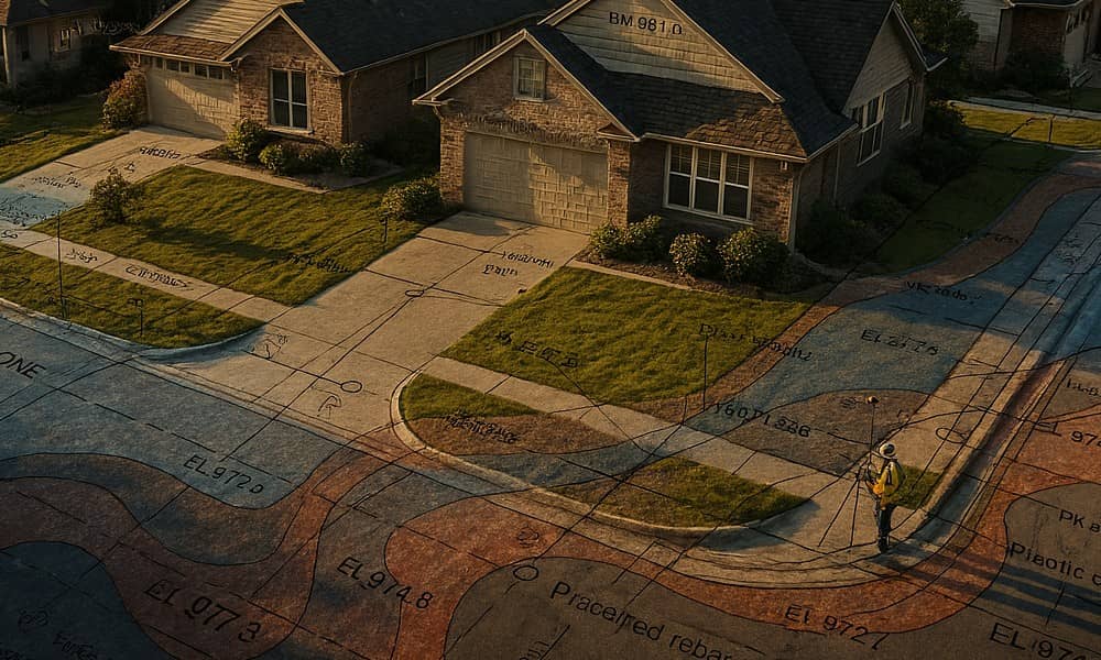
Think of it as your property’s x-ray. When flood maps change, the alta title survey confirms whether your home sits above or below those new lines. That’s information your lender and insurance agent both need.
Why This Matters for Tupelo Buyers
Tupelo is growing fast. New subdivisions are popping up near the city limits, where terrain varies from high ridges to creek bottoms. During construction, even a few inches of elevation difference can decide whether a slab stays dry or gets soaked. Builders, engineers, and banks rely on alta title surveys to avoid costly mistakes.
If you’re buying an older home, a recent survey is just as valuable. Some older plats still reference NGVD 29—a vertical system replaced decades ago by NAVD 88. Modern alta surveys use NAVD 88 benchmarks verified by GPS. That switch alone can shift your property’s reported elevation by several inches. When FEMA’s new maps come online, that difference might place you inside—or outside—the flood zone.
Real Lessons from the FEMA Controversy
The Montana story left three key takeaways that apply directly to Tupelo:
- Maps aren’t promises. A FEMA update can reduce your insurance cost, but it can’t stop water. Always verify with on-site data from a licensed land surveyor.
- Know your elevation reference. Ask your surveyor which benchmark system they use. Only NAVD 88 aligns with current FEMA and engineering standards.
- Expect lenders to double-check. When flood maps are labeled “preliminary,” banks often hold closings until the final determination letter arrives. An alta title survey helps keep your file ready once that happens.
These steps might sound small, but they save weeks of delays and thousands of dollars in surprise costs.
Where to Get Reliable Local Information
Tupelo residents don’t have to guess. Start with the City of Tupelo Development Services Department, which handles building permits and floodplain questions. Their staff can tell you if your property lies in a regulated area or needs an elevation certificate for remodeling.
For map data, visit:
- FEMA Map Service Center – to check official and preliminary flood zones.
- Lee County GIS Portal – for property layers and topographic views.
- Citizen Portal – to review subdivision or rezoning plans near your site.
After gathering that info, call a licensed land surveyor. Make sure they’re experienced with ALTA standards and FEMA elevation certificates. Local knowledge matters; surveyors who work daily understand its soil types, creek systems, and how rainwater actually behaves here.
Before You Buy or Build
Every smart homebuyer should take three quick steps:
- Ask for a current alta title survey. It verifies both boundary and flood-zone status using real measurements.
- Compare the survey’s flood data with FEMA’s map. Differences happen. When they do, your surveyor can prepare a Letter of Map Amendment (LOMA) request to correct errors.
- Schedule the survey early. It’s easier to fix boundary or drainage issues before you sign closing papers than after construction starts.
Following these steps keeps you ahead of the surprises that caught that Montana town off-guard.
The Map Isn’t Enough—The Measurement Matters
FEMA maps guide communities, but alta title surveys protect individuals. They prove where your property truly stands—literally. When flood maps shift or lenders tighten standards, that detailed survey becomes your best defense against costly rework or insurance battles.
In a city growing as quickly as Tupelo, land is valuable and information is power. Don’t rely only on what the map says. Rely on what the measurements show.
If you’re buying, selling, or building, talk to a local licensed land surveyor before you close. An alta title survey doesn’t just satisfy your lender—it helps you sleep better when the next heavy rain hits.


