If you’ve ever thought about putting up a new fence, you probably imagined the fresh wood smell, the neat border, and the sense of privacy it brings. But before the first post goes into the ground, there’s one thing many homeowners overlook: a property line survey. Skipping it can lead to headaches, neighbor disputes, and even costly tear-downs. In fact, a viral Reddit thread this week captured the frustration perfectly when one user vented, “Fence crews never care about stakes.” That single line sums up a problem more common than you’d think.
Why Fences Create Disputes
Tupelo is a growing city with a mix of older neighborhoods and new subdivisions. Some homes sit on land with clear plats, while others have records that are fuzzy or outdated. When you call a fence company, their main focus is building straight, sturdy panels—not checking legal boundaries. If the crew places posts a few inches over the line, that small mistake can spark a big fight with your neighbor.
Imagine spending thousands on a new fence only to be told it’s standing on the wrong side of the property line. At that point, you’re not just looking at an awkward conversation—you could be forced to move or remove the fence entirely. That’s where a property line survey proves its value.
What a Property Line Survey Actually Does
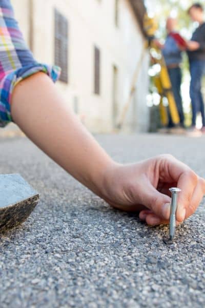
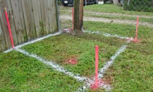
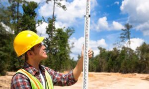
A property line survey is a professional measurement of your land’s true boundaries. Licensed surveyors use records, deeds, and field tools to locate and mark where your lot begins and ends. The result is both a physical marking—often wooden or metal stakes—and a detailed map you can share with contractors or keep on file.
In Tupelo, surveyors often deal with mixed terrain: tree lines, old subdivision markers, and lots that have changed hands many times. A fresh survey cuts through the guesswork. When those stakes are in place, there’s no debate about whose yard a fence belongs in.
The Viral Frustration: Stakes Ignored

That Reddit thread exploded with comments from people who had seen their survey stakes pulled up, buried, or ignored by fence crews. Some homeowners admitted they didn’t even realize what those little flags meant until they were gone. Others said their neighbors accused them of “cheating” the line, even though they had proof from a surveyor.
These stories aren’t just funny internet posts—they’re warnings. In the rush to finish a job, contractors sometimes treat stakes as obstacles, not guides. Once the markers are disturbed, you’ve lost your evidence. And without evidence, every claim about where the line should be turns into a he-said-she-said argument.
Law Protects Your Corners
Here’s something many homeowners don’t know: Law makes it illegal to willfully alter or destroy boundary monuments set by a licensed surveyor. In plain terms, those stakes aren’t just sticks in the dirt—they’re legal landmarks. If someone removes or damages them, they could be breaking the law.
This matters because it adds weight to your side if a dispute ever escalates. Having a recent property line survey, backed by state law, puts you on firm ground. It shows that your corners aren’t based on memory, old fences, or guesswork—they’re legally defined.
How to Keep Fence Projects on Track
So how do you avoid becoming another Reddit horror story? Start with communication. Share your survey map with your fence contractor before work begins. Walk the line together and point out the stakes. Make it clear they’re not optional markers—they are the plan.
It also helps to involve your neighbor early. When both parties know the survey results, the chance of conflict drops. Nobody likes surprises, and nothing feels worse than seeing a fence rise up in what you thought was your yard. A simple conversation backed by survey data builds trust.
During construction, check in as posts go in. Many surveyors recommend laying out a string line along the stakes so crews have a visible guide. Take photos of the stakes before work starts. That way, if anything gets disturbed, you still have proof of where they were.
When to Call the Surveyor Back
Even with careful planning, things happen. Heavy machinery might knock out a stake. A neighbor might challenge the line. Or maybe the markers were set years ago and no longer feel clear. In those moments, it’s smart to call your surveyor back for a remarking.
A re-visit costs far less than moving an entire fence. It also gives you peace of mind. Instead of arguing over inches, you’ll have a professional drawing and fresh stakes to settle the matter. In fast-growing areas like Tupelo, where new fences and home additions pop up every week, keeping your boundaries clear is more than a one-time task.
The Cost of Skipping the Survey
It’s tempting to save money and trust a fence crew to “eyeball it.” But that gamble rarely pays off. Consider the costs:
- Removing and rebuilding a fence.
- Paying legal fees if the dispute goes to court.
- Strained relationships with neighbors you see every day.
Compared to those outcomes, a property line survey is a bargain. It’s not just about measuring land—it’s about preventing stress, protecting investments, and keeping peace in the neighborhood.
Closing Thoughts
The viral frustration on Reddit shined a light on an everyday problem: fence crews ignoring stakes. For Tupelo homeowners, the lesson is clear. Don’t rely on luck or assumptions when it comes to property boundaries. Property line surveys are your first line of defense against boundary mix-ups, surprise costs, and conflicts next door.
A quick call to a surveyor before construction can save you a lot of worry. Fresh markers give you confidence that your fence is built in the right place.


